Identify Landscape Controls and Locations of Thermal Refugia
Many aquatic organisms seek cold water thermal refugia.
Many streams and rivers can become too warm for some aquatic species, including salmon due to lack of streamside vegetation and other natural topographic and vegetative conditions.
Do you know where the cold water refugia is located in your watershed?
Knowing the locations of different types of cold water refugia, and also warm water hotspots, could be used to better site in-stream and riparian restoration projects. Greater riparian protection could also be placed in and near cold water refugia.
NetMap can be used to create a provisional thermal refugia map at the watershed or landscape scale.
Identify four different types of potential landscape scale thermal refugia:
along channel due to topographic shading, stream size and orientation and current stream side vegetation
tributary scale refugia, same as above, but accumulated downstream revealing average tributary conditions
tributary confluences revealing the relationship between tributary scale thermal regimes and mainstem thermal regimes, and scaled by differential stream flows (colder, warmer confluences)
downstream spatial variation in valley/floodplain widths; valley/floodplain narrowing can lead to upwelling and cooler hyporheic water
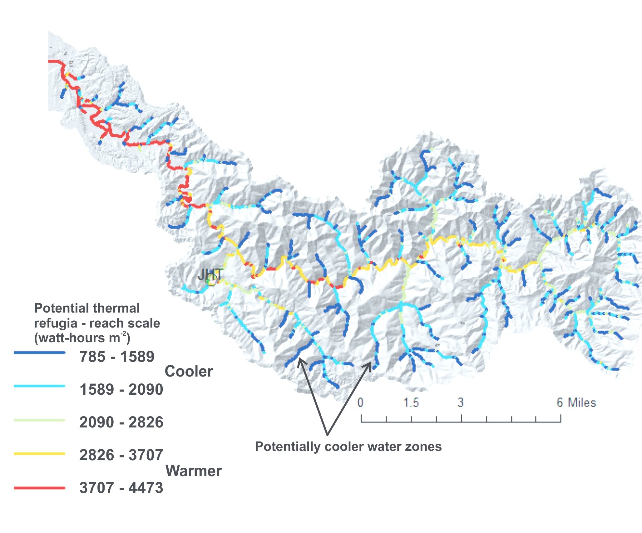
Stream Reach Scale (~ 100 m) Thermal Refugia
Local, reach-scale vegetative, topographic and channel conditions create patterns of potential cold and warmer waters.
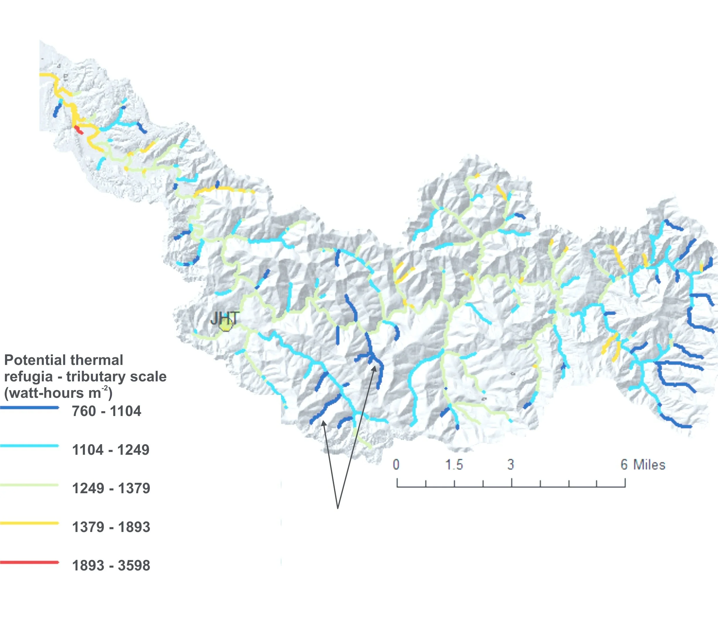
Tributary Scale Thermal Refugia
Reach scale thermal regimes can be aggregated at the tributary scale, revealing larger scale patterns of cooler and warmer waters.
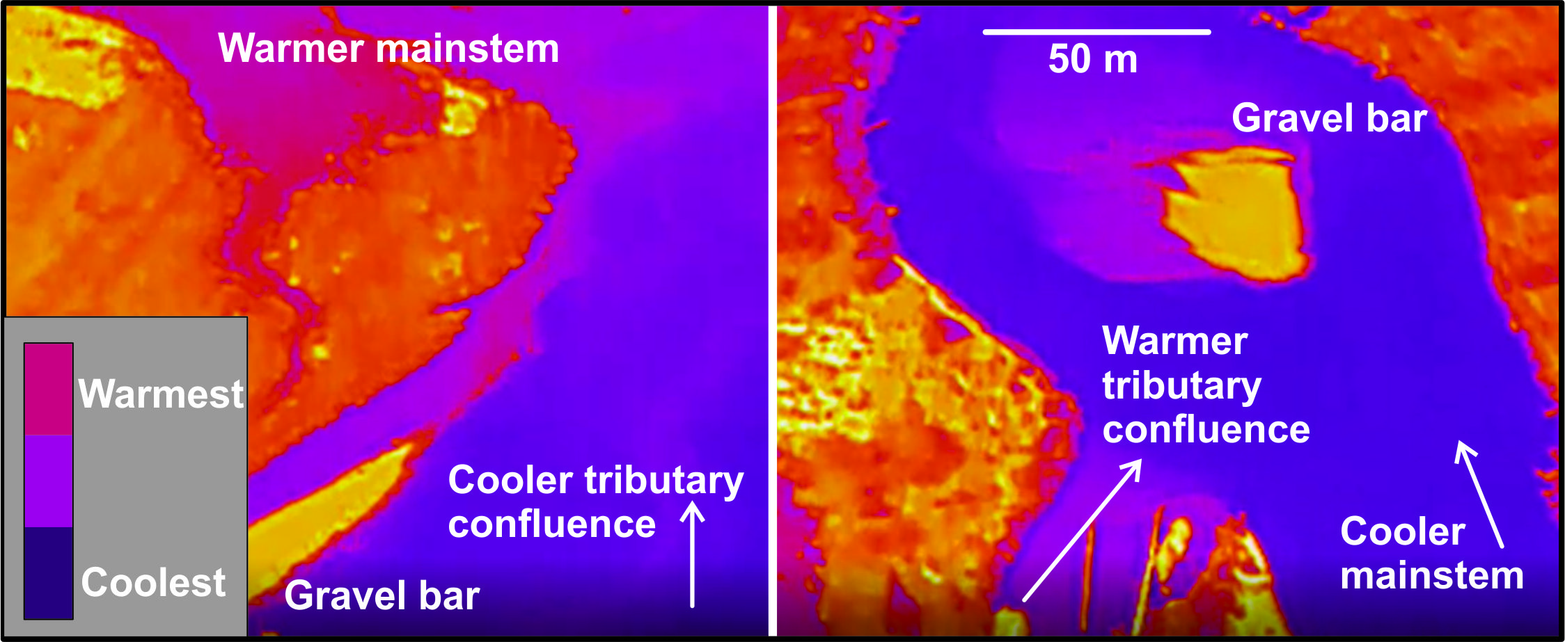
Tributary Confluence Thermal Refugia
Cooler tributaries can intersect warmer mainstems, and warmer tributaries can intersect cooler mainstems. Identifying these locations could inform more strategic in-channel and riparian restoration projects.

Valley/Floodplain Constriction Potential Refugia
Changes in valley morphology - from wider to narrower and back again, and the fluctuating floodplain sizes that accompany it - set the stage for sub-riverine flow, or hyporheic flow, to upwell bringing cooler water to the surface, or downwell. NetMap can identify these locations of potential cooler water upwelling locations.
Such information could be used to strategically place in-channel or riparian restoration projects.
